Meghalaya was a place me and wifey both wanted to visit since a long time. Not many people visit north-eastern India but it is quite a beautiful place and not as crowded or commercialised as rest of tourist destinations in India, though it is getting there, Our trip lasted for 9 days during last week of June and 1st week of July, during the peak monsoon season. It was significantly hotter than what we had expected, but worth it. As with most of our travel plans, the itinerary we followed was a lot different than the one we “planned”.
Our flight departed at around 5 am and we were out of Guwahati airport by 7:30 am. We met our driver there and started the long road drive towards Tura in West Garo Hills. We had booked a car for the duration of our trip. The driver was a Bengali muslim from Assam and had been only to Shillong, Cherrapunji side because according to him, nobody else visited anyplace else. He tried his best to get us to change our plans by saying that there are militants everywhere, it’s like Wrong Turn movie and so on. Being from Jammu, such kind of talk only annoys me and I just asked him to keep quiet and follow the plan which he did more or less. We stopped at one road side dhaba some where in Assam for a late breakfast. They had paranthas available and we ordered 3. But a single parantha there used more than 2 times the flour than we’re used to and we struggled to finish one each. They also served some mixed vegetable, which I don’t remember.

The drive was long and unremarkable apart from the fact that Meghalaya had a lot more greenery and general cleanliness than Assam. Now as I am writing this, Assam is reeling under floods. When one sees how the people have destroyed forest land, blocked off water channels and constructed over wetlands, it’s only obvious that the place will go under water like clockwork, but I digress. We took a comparatively long route of highway 127B and reached our guesthouse in Tura late afternoon. The guesthouse was nothing really fancy but adequate. After some rest, we took a walk but there wasn’t much to see. Lack of sleep previous night and long drive had tired us and we had an early dinner before going to sleep. Wifey is a vegetarian so she just asked for the usual daal, while the owner prepared a local fish dish for me.

Next morning, we called the state tourism office and asked for some advice. They promised to arrange a local guide for us.In the meanwhile, we asked the driver to take us to Pelga Falls. We were following Google Maps which proved to be entirely useless in showing directions and the driver was even more useless. In the end we ended up on a dirt track a few km outside the town that the locals claimed led to Pelga Falls. We could barely understand them and driver’s comprehension was hardly any better.
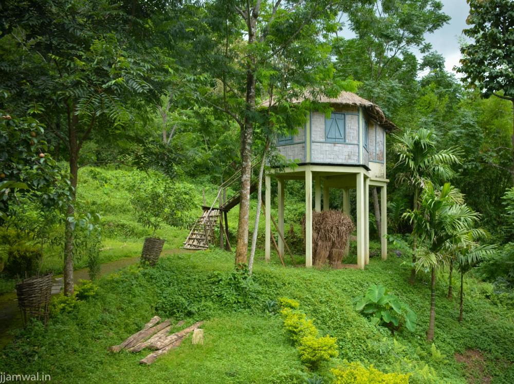
Me and wifey started walking but started sweating profusely very soon. The weather wasn’t that hot, but very humid. Most of the time, we were walking under shade of trees but that just protected from sunshine. There were a few small houses made of bamboo and cane every few meters on the way but very few people and no tourists. There were some auto-rickshaws plying on the route though. Most of the houses had goats, chicken and some pigs walking or lying around.

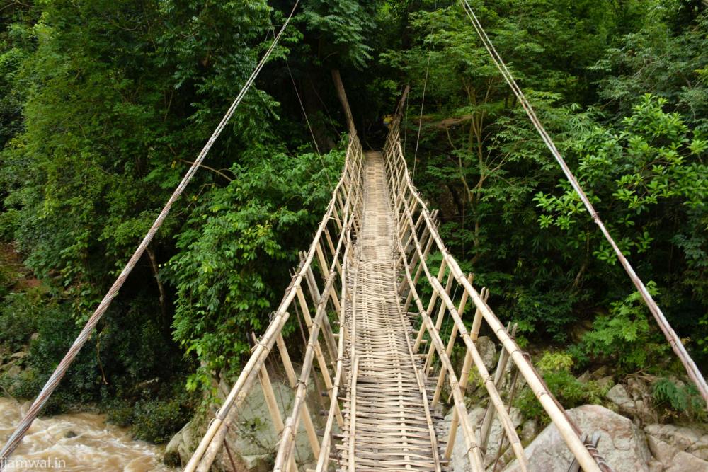
We reached Pelga Falls after walking for 35-40 minutes and found a small bamboo cane bridge a few meters upstream. A few workers were doing some repair work on it.. The stream was flooded and the water made a lot of noise even though the height was only 16-17 feet. I went on the bridge to see what was on the other side but quickly had doubts about my decision. It shook under my weight and for most of middle part the hand rails were quite below my reach making it tough to hold the camera and walk at same time. Later on this bridge was just one of many such shaky bridges we crossed, but I hadn’t expected this so soon. Anyhow, workers on other side of bridge were busy installed a bamboo ladder and there was no way to climb down from there forcing me to come back.

We saw some children coming back from school and a few locals and all were pretty friendly and curious even though language was an issue. They could understand only a bit of Hindi and even less English and their pronunciation was quite hard to understand. While we were driving back, the officer from Meghalaya tourism called us to inform that they had arranged guides for us. They arranged to have them meet us in Tura while we had lunch. The guides were two young men probably still in college and could communicate only a bit better than the villagers. We decided to visit the tourism office to get a better idea anyway. The officer we were talking to on phone was really helpful but her information also got us to change our plans of visiting a wildlife sanctuary nearby and 2-3 other places we had shortlisted. She was a gazetted rank officer and it’s very rare to see government officials of her level being so courteous and helpful like her. We decided to plan our stay in West Garo Hills according to brochures, maps and other verbal information she gave us. She even called some hotels and people on our behalf.

We planned to visit Katta Beel lake which was marked as 70 km on the map same day and move on to some other place next day. The two guides joined us even though only one was needed as we were their first ever clients. Interrupting the story here to say that DO NOT TRUST TOURIST MAPS OR GOOGLE MAPS, BROCHURES AND EVEN THE DIRECTIONS PROVIDED BY LOCALS. Everything is wrong. Brochures and tourist department people said 60 km, but it was atleast 20-25 km further away.
Most of the roads were in good condition apart from a few stretches every now and then. Surprisingly, there were a lot of wooden bridges which were being phased out with concrete and steel bridges, but it was surprising for us to see such old bridges. Along the way, we passed some villages and most people were dressed simply in local attire and at first glance looked still not that affected or changed by outer world. One thing that I noticed that day and rest of our stay there was that there were a lot more churches than schools and other public buildings. Almost every village had one or more huge churches but fewer and smaller schools. Even the guesthouse we were staying in had a huge church right in front and a 6-7 room school next to it. There was a “big” college on the same street and even that was much smaller than that church.
Coming back to the topic, it took us more than three hours to reach Katta Beel, a small lake right next to India-Bangladesh border. Apparently it was dug up by a king in 7th or 9th century. It’s not a bad place, but not worth the long drive. While we were going back, a local asked us to go a bit further and visit some ancient fort and temple. The road went along the border and we entered the Bangladeshi territory for a few meters but couldn’t find the place. The sun was fading the the fence closing in 40-45 minutes so we chose to go back rather than search more.
Next morning, we left Tura with intention of stopping at Rombagre or Chandigre. Found Rombagre first which was a drive of around 90-100 minutes. There was also on Selbagre Gibbon reserve which we saw on the way, but didn’t really feel like going there as we wanted to confirm a place to spend the night firts. It’s a very small village with just a single inspection bungalow (IB) for accommodation. It was on other side of the river and only way to cross it was via a suspension bridge made of steel and wood. The steel structure looked sturdy enough but the quite a few planks for the walkway were either missing or cracked. The caretaker was not there and we asked locals who pointed us to his house. After 20-25 minutes, he came half running and unlocked a room for us. While we were waiting for him to arrive, I climbed up a pathway on a nearby hill to the village there. It was a pretty place with bamboo houses, huge trees, large courtyards and various pet animals. IB was on other side, just outside main village. Contrary to what we were expecting, the room had running water sourced from a small stream. The village had electricity but not the IB. But that was fine with us. After putting away our luggage, we drove 3-4 km further to a waterfall. A trail went on further but the caretaker said that the bridge broke a few weeks back and we couldn’t go there. We stopped at a small village where a NGO was operating a shelter for endangered gibbons and other primates.Apparently some jerks capture these primates and keep them as pets or sell off. This NGO rescues such animals before releasing them in to wild. Normally I don’t care for NGOs, but they seem to be doing good work in hard conditions.

On the way, there was a small market going on along the road and a platform constructed above a pool in river from where people can feed the fish. A snake was lying on rocks trying to catch something for lunch, but most fish seemed too big for it. After we reached back to Rombagre, care taker went off to cook dinner while we cooled off in the river. There were quite a few fishes there too and I fed them some of the snacks we were carrying, much to wifey’s annoyance. We watched some local kids playing football till it started getting dark and we walked back to our room for dinner. More in next post.

Leave a Reply