Here is satellite imagery showing marks of a munitions hit on Pakistani nuclear storage facility in Kirana Hills.

The facility has storage site for conventional munitions as well as nuclear weapons. This section, which is constructed under the rocky hill, most likely serves as storage or command centre for a part of Pakistani nuclear arsenal. The image quality is not as good as I wanted, but it’ll have to do for now. A regular warhead would’ve exploded on surface causing a large crater and a lot of rubble.
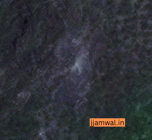
Here, the small hole indicates use of a ground penetrating warhead which penetrated a few meters before exploding. The size of crater will be small as the explosion & it’s effects will be felt underground.
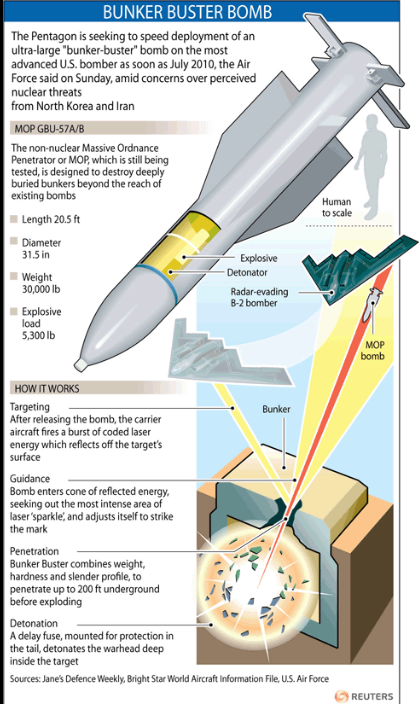
A Brahmos version was designed to hit targets on a vertical dive for targets like this. Armed with ground penetrating warhead, it can bore through meters of rocky ground & reinforced concrete when diving at ~ Mach 3 speed.

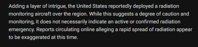
Even if underground bunkers are not penetrated, the shock waves can cause serious damage inside. It’s very unlikely that the nuclear warheads will explode, but their chemical explosives can. It can cause some radioactive fallout, but chances of it escaping the bunker are low. Presence of aircraft with radioactivity sensors & evacuation of nearby villages indicate corresponding precautions being taken.
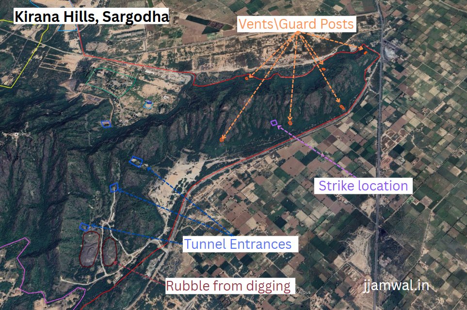
This is the corrected location of 1 (out of 2?) hits on the facility marked in 1st image. Contrary to what some people have been saying, the hills are not empty. This section has had underground facilities for years.
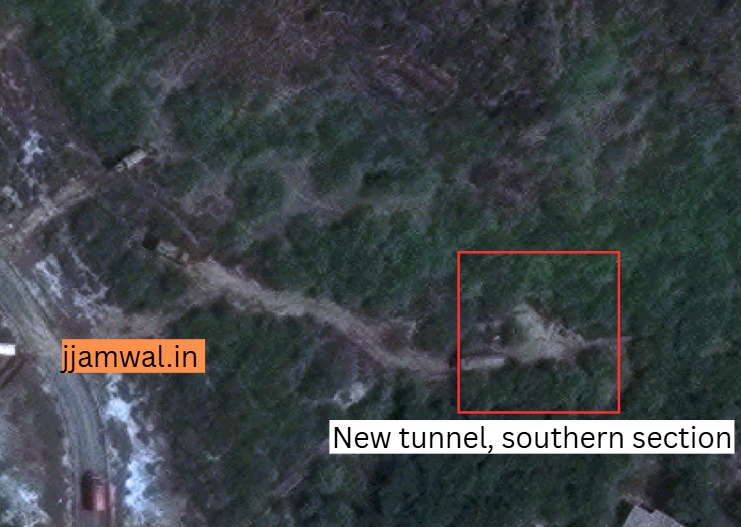
Even the hills in southern section are being dug up.
Conclusions:
- Kirana Hills was hit twice.
- Target was very likely Paki nuclear facility
- Purpose, unknown.
- Damage. Unknown, but along with other hits, good enough to break paki military’s morale.
- Any nuclear explosions happened, no.
- Radiation leak, rather limited if any.
The satellite image was procured at considerable expense through the generosity of someone patriotic who wishes to remain anonymous. Many thanks to him/her.
Twitter link:
Leave a Reply